Kerinci Mountain
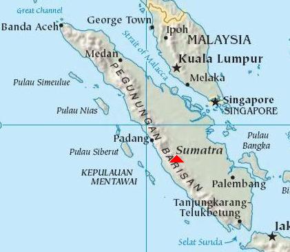
Mount Kerinci is the highest volcano in Indonesia with a height of 3800m above sea level and is still in an active state. Located at latitude 10 ° 45.50 'S and 1010 ° 160' longitude. Located in two districts of Kerinci and Sulak Running. This leg of the mountain you can find tea plantations located in the village Tuo grit.Tuo gravel in this village there are many inns are run by local residents. Residents in this village Tuo grit is the Javanese majority who have lived there a long time, since the Dutch colonial era.
Mount Kerinci is under the protection of Nasioanal Park Kerinci Semblat. On this mountain forest areas we still can find a tiger sumatera. One thing that should be in mind, if you climb this mountain, do not spend the night or put up tents in the area I or area selter altitude below 1500m above sea level.
Because this area is sumatera tiger habitat and where they hunt. And try not to bring food or rancid smell of raw meat.
The view from the summit of Kerinci a compelling, we can see the lake and the lake situjuh KERINCI above the top of the hill situjuh, and in the south looks Lubuk Gadang and Labuh Estuary.
While in the west Indian Ocean visible. very beautiful. Mount Kerinci can be achieved through Jambi city or town of Padang, or also from Muara Bungo. Muara Bungo is located in Sumatra Cross road between the provinces of Jambi and West Sumatra.
Route
- Pondok R10 (1611 m above sea level) - Door Woods (1800 m above sea level).
R10 is a guard shack TNKS hall to watch every visitor who will climb the mountain Kerinci. Terrain of the plantation / farm population, good road conditions (asphalt) to the forest boundary. Mileage 2 km or 1 hour drive.
- Door Rimba - Post Bench Long (1909 m above sea level).
Doors Woods is climbing in the starting gate in the forest boundary between heterogeneous fields and forests as the entrance, here there is also the location of shelter and water approximately 200 meters to the left if we are facing a mountain of Kerinci.
Mileage to the Bench Length 2 km or 30 minutes travel, trekking path is relatively flat.
- Post Bench Length - Pos Batu Pond (2000 m above sea level).
Heading length bench there are two shelters that are practically feasible. Towards the Stone Moss still climbing sloping terrain and distance of about 2 km with 30 minutes travel time.
- Post Rock Pond - Shelter 1 (2225 m above sea level).
Moss Stone heading a place to rest but there is no shelternya but here there is the location of the water (sludge water). It is located on the river but the river is the only watery konterporer rainy season.
Shelter mileage to 1 as far as 2 km trip with travel time 1 hour. The condition is relatively steep trails with a slope of about 60.
- Shelter 1 - Shelter 2 (2510 m above sea level).
Shelter 1 is a place of rest, consists of one hut is still well maintained, mileage to post 2 of 3 km with a 1.5-hour travel time. On this path occasionally steep path up the slope 45.
- Shelter 2 - Shelter 3 (3073 m above sea level).
Shelter 2 is a place of rest, with one shelter, but not too strong. Perhaps because of age is quite an old cottage and conditions of the temperature field dratis make this shelter survived, although in a state tilted almost collapsed.
Mileage to the shelter 3 is 2 km with a 2-hour travel time.
- Shelter 3 - Shelter 4 (3351 m above sea level).
Shelter 3 is the only place to rest just tingga iron framework. This location is an open field and can look towards the village of gravel Tuo.
This place is too good to be a place set up a tent. because of the fairly flat area. Here also we can find the source of water. The journey to the summit was only a 3 hour drive from this shelter.
Toward shelter 4 distance of 1.5 km with a 1-hour travel time. Condition of walking trails are former water flow into the ascent path.
- Shelter 4 - Limit vegetation / Sand / Stone Rocks - Peak (3800 m above sea level).
This place is a bulletin board that contains prohibitions establish new routes and information about the path of sand and rocks please be careful.
Broad field. Here can be set up tents as long as your tent to meet the requirements established here, because here the wind was blowing quite hard and cold temperatures.
LICENSING
Permitting for climbing this mountain, including standard and not too complicated. Could permit the Postal maintained national park ranger.
PLACES OF INTEREST
There are some interesting places that might be visited include:
- Kebon tea Tuo grit
- Lake Belibis
- Lake KERINCI
- Lake Situjuh mountain Situjuh
Also on the site Kerinci Seblat National Park also contains the so-called community KERINCI PEOPLE. This community until now is still very difficult to find. French anthropology team is still investigating. According to locals, this KERINCI people have high posture children aged 3 years and had long hair.
Unique from them is their feet upside down, not like we are behind the heel but the heel is this KERINCI front and fingers facing backward.
Their movement is very fast, fast sangking french photograper investigators could not take pictures of them even had to face. The results of the investigation team this French anthropologist can be seen at their offices in the city full River. There are photos of their footprint as big as the palm of a child's foot.


0 Responses to “Kerinci Mountain”: